Katmai National Park.
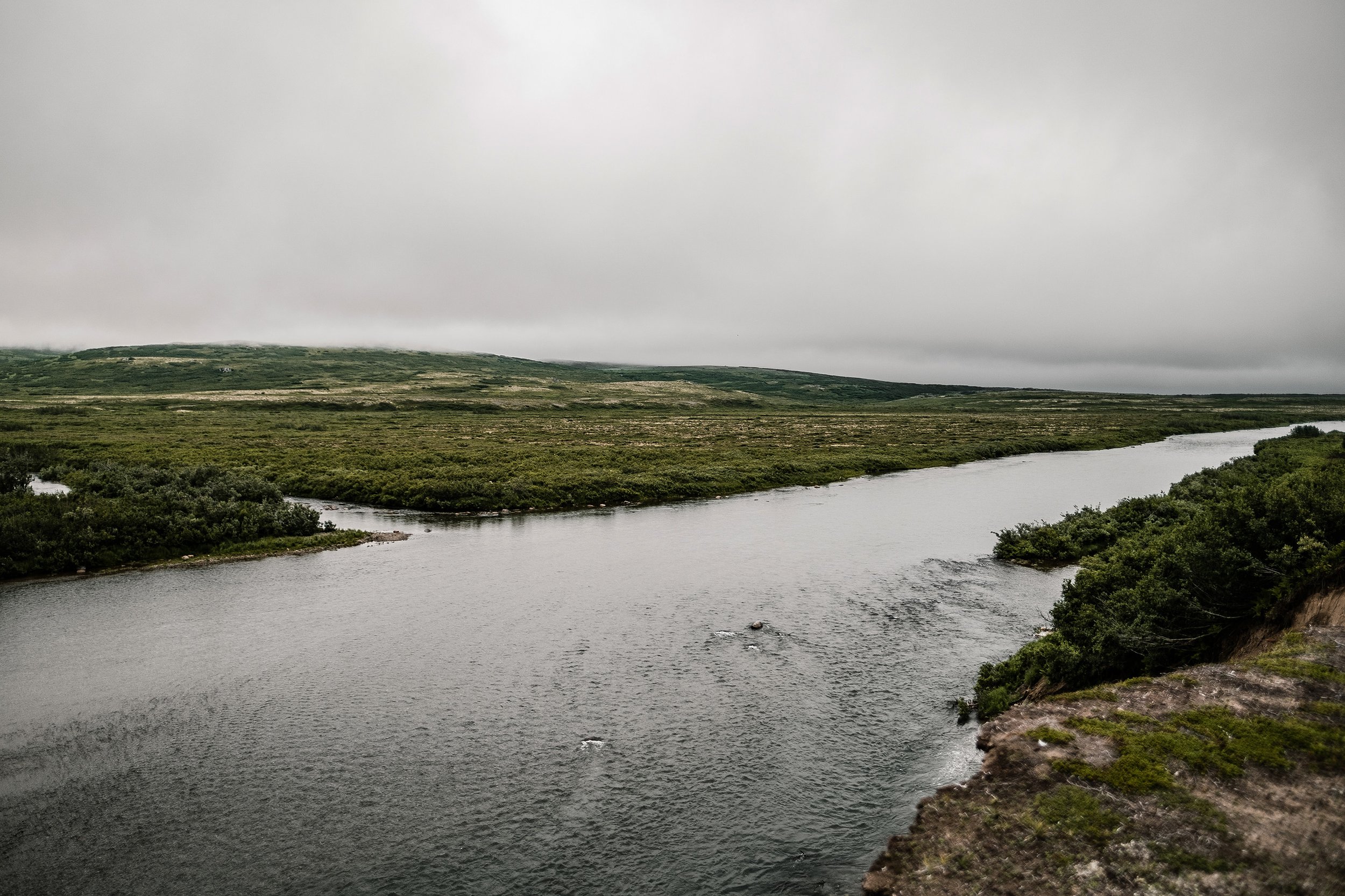
Katmai National Park and Preserve is on a peninsula in southern Alaska. Its wild landscapes span tundra, forests, lakes, and mountains. The park is known for the many brown bears that are drawn to the abundant salmon in Brooks Falls. Lookout platforms at adjacent Brooks Camp offer close-up views of the bears. The Valley of Ten Thousand Smokes is an area of lava flows and ash formed by a massive volcanic eruption.

Welcome to Katmai Country
Katmai National Park and Preserve in Alaska is home to spectacular and unique volcanoes,
and wildlife including fish, flowers, and bears.
A landscape is alive underneath our feet, filled with creatures that remind us what it is to be wild. Katmai was established in 1918 to protect the volcanically devastated region surrounding Novarupta and the Valley of Ten Thousand Smokes. Today, Katmai National Park and Preserve also protects 9,000 years of human history and important habitat for salmon and thousands of brown bears.
Katmai was declared a national monument in 1918 to preserve the living laboratory of its cataclysmic 1912 volcanic eruption, particularly the Valley of Ten Thousand Smokes. The intervening years have seen most of the geothermal features cool, but the protection of brown bears has become an equally compelling charge for Katmai. To protect this magnificent animal and its varied habitat, the boundaries were extended over the years, and in 1980 the area was designated a national park and preserve. Katmai's awe-inspiring natural powers confront us most visibly in its volcanics and its brown bears.
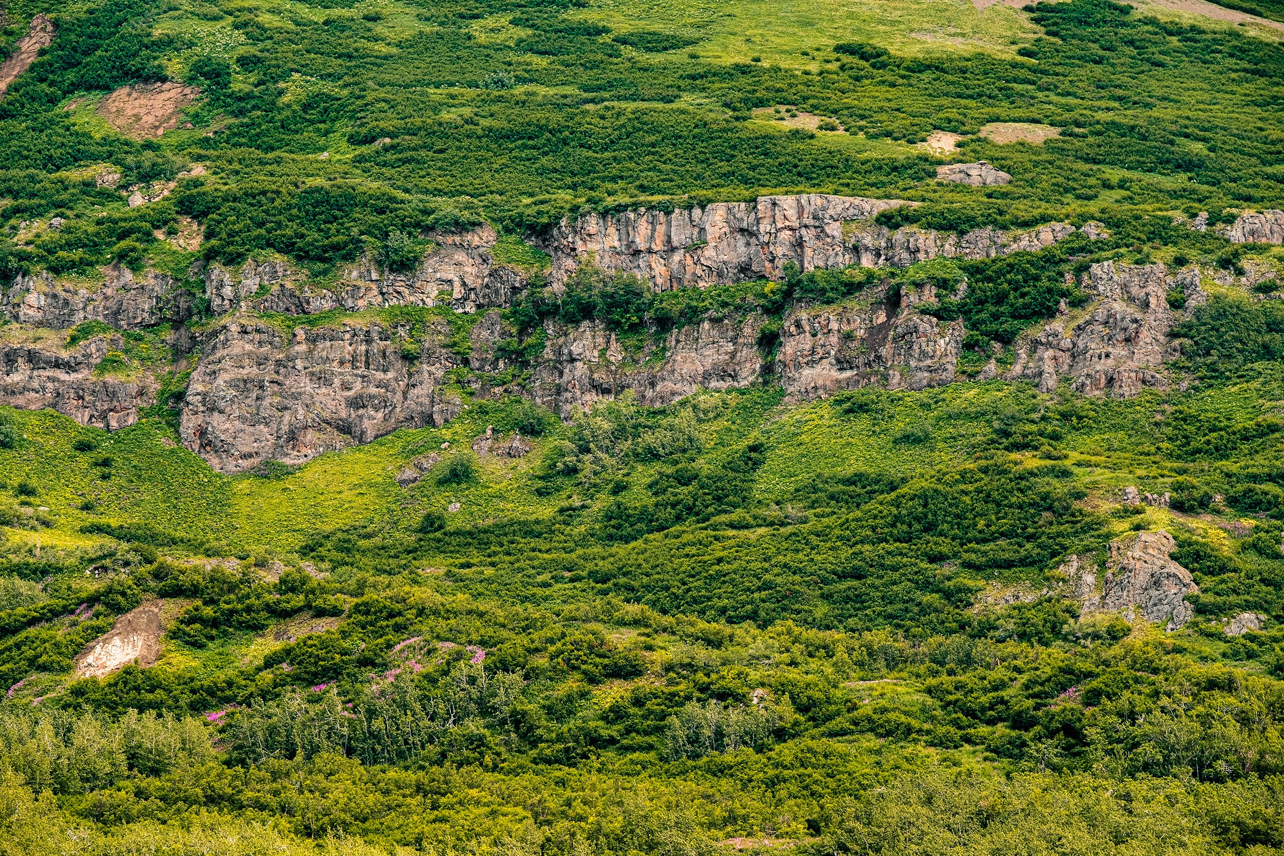
Most people who visit Katmai fly to their destination. Above the land and water, people see a land pock marked with ponds and lakes, cut with deep valleys, and rippled with glacial moraines—all of which is set next to the rugged spine of active volcanoes. Katmai National Monument was established in 1918 because of its geology. The stories of the rocks, volcanoes, fossils, and glaciers of Katmai reveal the formation of this landscape.

World Famous Brooks Camp.
-
Situated at the mouth of the Brooks River and the shore of Naknek Lake, Brooks Camp attracts people from all over the world to view brown bears, enjoy world-class fishing, and learn about the long human history of the area. It is also a starting point for many backcountry adventures.
-
While Brooks Camp offers many public services and accessible options unavailable elsewhere in the park, visitors must arrive prepared to experience backcountry Alaska. Whether staying for just a few hours or for several days, you should expect to encounter windy, rainy, and cold conditions. Be sure to dress and pack in anticipation of diverse and changing weather conditions.
-
New in 2022, you will need a permit for any activities within in the Brooks River Corridor, with the exception of redfish fishery subsistence activities. This corridor includes the river itself and 50 yards from the water's edge on either side along the banks of the river from the Lake Brooks inlet downstream to the elevated bridge and boardwalk. This does not include graveled roads trails, boardwalks, or wildlife viewing platforms. A permit is also not needed for any travel to or from villages or homesites. Permits are needed from July 1 until October 31 when the salmon are spawning. Each permit will be valid for 7 days with a maximum group size of 6 individuals. Permits are free but there is a $6 booking fee that will be charged. Commercial Users and Visitors will be able to obtain permits before arriving to the Brooks River on www.recreation.gov. Alternately, a one day only river permit is available at the Brooks Camp Visitor Center during posted hours the day of a visit. See the official press release to learn more.
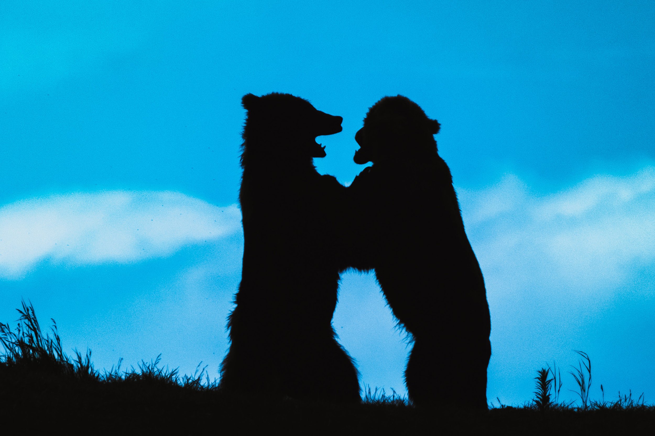
Katmai National Park and Preserve is approximately 260 miles southwest of Anchorage and is a true wilderness destination. Some come for the otherworldly volcanic landscape of the Valley of 10,000 Smokes, but most come for bears. About 2,200 brown bears inhabit the park and many congregate on the Brooks River to gorge on summer salmon runs, making this one of the best spots for bear viewing in Alaska.

BEAR VIEWING IN KATMAI NATIONAL PARK
The hub of bear viewing and other activities in the park is Brooks Camp, the park's summer headquarters on the shores of Naknek Lake. The camp features a lodge and restaurant, a campground, a store, kayak rentals, and the Brooks Camp Visitor Center, where visitors can sign up for daily ranger-led tours in the park. Unconnected to any town by road, most people come to Katmai via floatplane or boat from from King Salmon, or floatplane from Anchorage, Homer, or Kodiak. Floatplanes and boats load and unload passengers right along the shore at Brooks Camp.
Visitors to Brooks Camp are required to check in at the visitor center for a quick bear safety orientation. From there, a trail and floating bridge leads to the most popular attractions in the park: a series of bear viewing platforms overlooking the Brooks River. The deck at Brook Falls is the prime viewing area, where visitors can photograph salmon making spectacular leaps with 900-pound brown bears at the top of the waterfall waiting with open jaws. Thanks to an incredible sockeye salmon run, there might be a dozen bears fishing in the area at the same time. Wolves sometimes stop by to fish, too.
The Brooks Falls viewing platform can be busy at times, though it's the worth the wait to get a front-row view of the action. Don't forget to check out the other platforms for additional viewing options - and keep an eye out for bears wherever you go! You can see bears along trails and even right at Brooks Camp when you step off your boat or float plane. The floating bridge adjacent to Brooks Camp is another prime bear viewing area, with bears fishing in the river and on the shores of Naknek Lake in nearly every direction you look. Brooks Falls is the most iconic bear viewing spot in the park but make sure to give yourself time to watch bears in other areas.


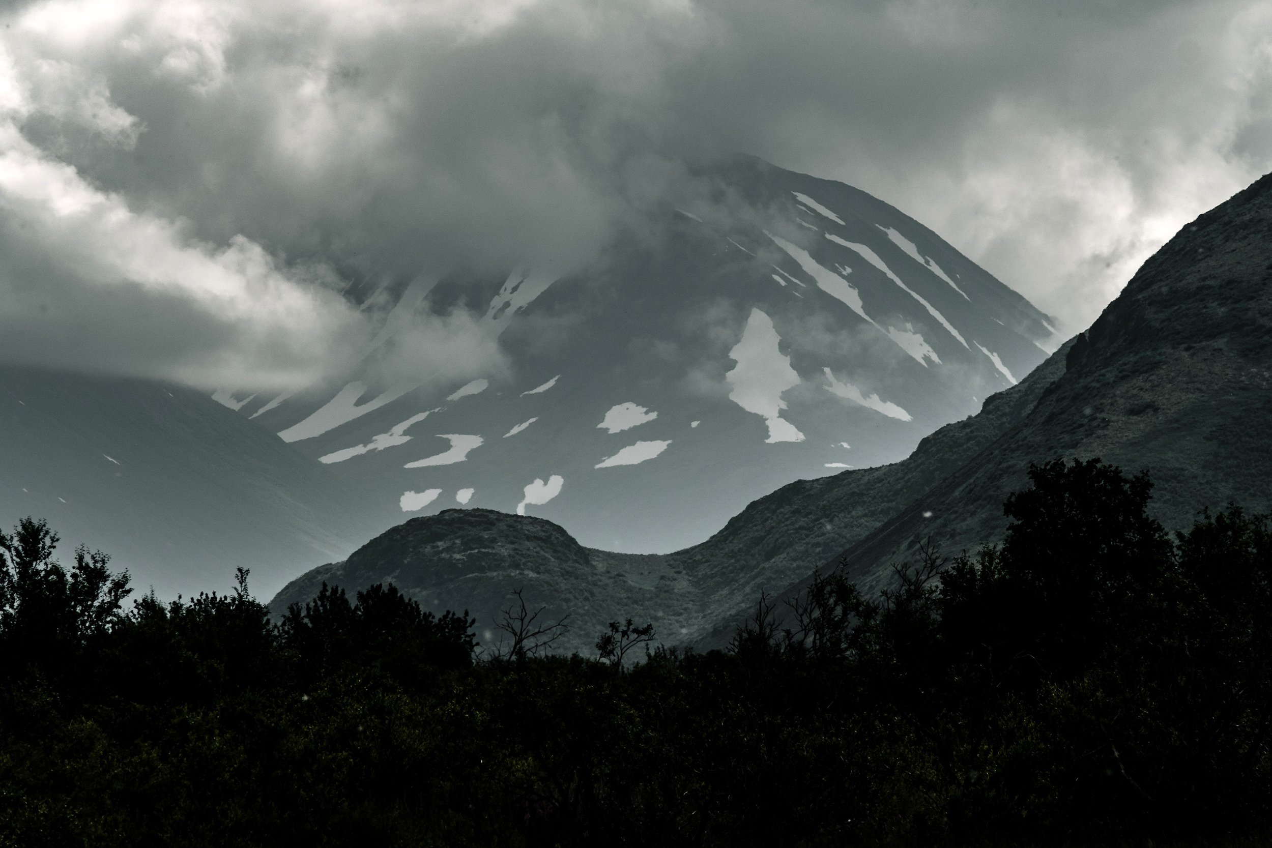
Valley of Ten Thousand Smokes
The Valley of Ten Thousand Smokes is a valley within Katmai National Park and Preserve in Alaska which is filled with ash flow from the eruption of Novarupta on June 6–8, 1912. Following the eruption, thousands of fumaroles vented steam from the ash. Robert F. Griggs, who explored the volcano's aftermath for the National Geographic Society in 1916, gave the valley its name, saying that "the whole valley as far as the eye could reach was full of hundreds, no thousands—literally, tens of thousands—of smokes curling up from its fissured floor."

Departing from Brooks Camp is the Valley of 10,000 Smokes Road, the only road in Katmai. This 23-mile dirt road winds past wildlife-inhabited meadows and river valleys and ends at Three Forks Overlook, which has a sweeping view of the Valley of 10,000 Smokes. This harsh but spectacular landscape was created by the largest volcanic eruption of the 20th century. On June 6, 1912, the Novarupta Volcano spewed ash and volcanic matter for 60 hours, blanketing the mountainous landscape in ash.
The Valley of 10,000 Smokes is now a popular destination for hiking and camping for those with backcountry and route-finding experience - there are no designated trails in this section of the park. Daily bus tours from Brooks Camp head to Three Forks Overlook and back, stopping along the way to pick up hikers and backpackers.

Destinations in the Valley of Ten Thousand Smokes
-
The western side of the Valley is bordered by this ridge. Along the Buttress Range, several small, inset alcoves provide water and inviting places to camp. Wildlife such as bears, ground squirrels, ptarmigan, and even caribou can be seen in this area. The crest of the Buttress Range is easily traversed along its length.
-
Katmai Pass is one of the lowest points in the crest of the Aleutian Range in Katmai. It offers a relatively easy route between the Pacific Ocean and Bristol Bay watersheds. Until the 1912 eruption, a trail through Katmai Pass was frequently used by Alaska Natives as a trade route.
While the historic trail through the pass was buried by ash and pumice, the area still provides many places to explore. Hikers moving south through the pass can explore the lava flows from southwest Trident and the warm springs that seep from underneath them. Hikers moving north through the pass can imagine what Robert Griggs saw in 1916 when he first gazed upon the steaming valley. The summit of Observation Mountain, several miles south of the pass, offers amazing views of the Katmai River gorge and valley.
-
The lower slopes of the Knife Creek Glaciers are covered with as much as 6 feet (2 meters) of ash and pumice. Hikers can walk right up to the foot of and even on the glaciers, with caution.
Three thousand feet above the glaciers lays the caldera of Mount Katmai. The summit of Mount Katmai collapsed during the 1912 Novarupta eruption leaving a caldera more than 2000 feet (600 m) deep. All routes to the caldera require crossing glaciers with crevasses.
-
This is the tallest mountain bordering the Valley of Ten Thousand Smokes. Ascents of Mount Griggs can be made from its relatively gentle western slopes. The final approach to the summit requires a tricky traverse of glaciers and a snow and ice covered knife-edged ridge. In late summer, water can be difficult to find near the base of Mount Griggs.
-
When explorers first entered the Valley, they found the toe of two glaciers occupying the basin where two beautiful, but distinct lakes sit today. Surrounded by cascading waterfalls, a muddy, silt-laden lake can be found where the Buttress Range meets the slopes of Mount Mageik and Mount Martin. Closer to Katmai Pass, a turquoise colored lake can be found.
-
It is a mere bump on the Valley’s floor and rises only 200 feet (65 meters) above its surface, but despite its small size this volcanic dome marks the vent of the largest volcanic eruption of the 20th century. When explorers first entered the Valley, this was one of the hottest areas and the dome still wafts warm steam. Superheated jets of steam from nearby fumaroles cooked the surrounding ash and pumice and deposited kaleidoscopes of minerals. The area near Novarupta is the most colorful in the Valley.
Novarupta is located approximately 14 miles from the Windy Creek trailhead on the Valley Road. Water draining from perennial snowfields is typically available near Novarupta, even in late summer.